


Digital Gender Atlas has been developed to identify the low performing geographic pockets for girls, particularly from marginalised groups such as scheduled castes, scheduled tribes and Muslim minorities, on specific gender related education indicators.
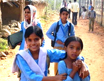
India has achieved high enrolment rates for girls at primary and upper primary levels of schooling. However, at the secondary level girls' enrolment remains low. Pockets of low performance persist across the country in many states. That all girls are not in school yet, is amply reflected in the low rural female literacy rates, the prevalence of Special Focus Districts (SFD) and Educationally Backward Blocks (EBB), low attendance rates and the number and proportion of out of school girls. What the data reveals about girls' needs further analysis to identify the bottlenecks for targeted planning, for effective implementation and monitoring.
In this scenario, a Gender Atlas for the country has been developed to highlight the issues, geographies and social background of girls that are still a concern and require urgent attention. The Gender Atlas is based on existing data and highlights problem areas to serve as pointers for intervention priorities. It is seen as a management tool that can focus on 'demand' and 'supply' side issues alike that impinge on girls' education.
- To identify low performing geographic pockets for girls, particularly from marginalised groups such as scheduled castes, scheduled tribes and Muslim minorities, on specific gender related education indicators.
- To ensure equitable education with a focus on vulnerable girls, including girls with disabilities, the Gender Atlas has been developed as a hands on management tool to enable critical decisions and action in pockets where performance is below par.
Salient features
- The architecture of the Atlas enables dynamic navigation between geographical representation and numeric data that presents State, District and Block level status on key parameters for girls' education at primary, upper primary and secondary levels. Thus, upon making a change in either the Search/Geo Search Tabs, the maps on the screen automatically change.
- The Atlas provides a comparative composite index based on quartile ranking of gender related indicators at National, State, District and Block levels.
- The Atlas enables a trend analysis and tracking of performance of individual gender related parameters across periods of time.
- The Atlas is constructed on an open source platform with an in-built scope of updating data by authorized persons to retain its dynamic character.

- The Atlas is based primarily on District Information System for Education (DISE) and Unified District Information System for Education (U-DISE) data (2011- 2014), the National Education Management Information System (EMIS) for elementary and secondary education.
- The Atlas draws on the Census of India 2011 for data on rural female literacy rates, working children in the school going age group, and the District Level Household and Facility Survey (DLHS) 2007-08 for data on age at marriage.
- No primary data has been generated for developing the Atlas.
- The analysis framework and formulae used in the EMIS has been used for data analysis and indexing.
- The Atlas uses the quartile ranking method to provide a comparative picture of performance on gender related education indicators within specific geographies.
Atlas design
The Atlas is designed around the two broad areas of performance of girls' education and vulnerabilities visualized in the following five sections:
Comparative Composite Index based Quartile Ranking grouped under categories of access, infrastructure, teachers and outcome indicators and based on 25 indicators pertaining to primary, upper primary and secondary level which can be visualized at State, district and block level.
A Trend Analysis of the performance status of 25 individual indicators can be visualised at State, district and block levels over three years viz 2011-12, 2012-13 & 2013-14.
Spatial Distribution of Special Focus Districts. These are districts with a population of 25% and above of people belonging to Schedule Tribes (109 districts), Schedule Castes (61 districts), Muslims (88 districts with a muslim population of more than 20%), minority community (121 districts as identified by Ministry of Minority Affairs under PM's 15 PPP), Left Wing Extremist affected districts (88 districts identified by Ministry of Home Affairs), Beti Bachao Beti Padhao (BBBP) districts (161 districts) and Educationally Backward Blocks (3479 blocks).
Vulnerability status of an area based on a composite index of 3 broad indicators (i) rural female literacy (ii) percentage girls/boys married below the legal age of marriage and (iii) working children can be visualized. Separate visualisations are given for working children for the following sub-indicators: disaggregation by gender and age for the 5-9 years, 10-14 years and 15-19 years age groups as well as for marriage below the legal age. These maps are available up to the district level.
Children with Disabilities: The performance status of six individual indicators can be visualized at state and district level across three years i.e. 2011-12, 2012-13 and 2013-14.
Related Links

