

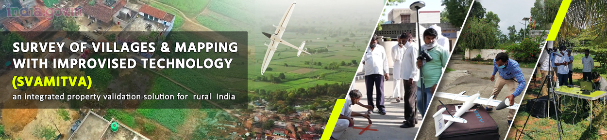
Hon'ble PM launched the SVAMITVA Scheme (Survey of Villages Abadi and Mapping with Improvised Technology in Village Areas) on National Panchayat Day 24th April 2020 with the aim of survey of inhabited areas of villages using progressive technology to provide an integrated solution for property validation in rural India. The scheme's intent is to provide the 'record of rights' to village household owners so that they can use their houses as financial assets to take loans and other financial benefits from Banks.
Ministry of Panchayati Raj (MoPR) is the nodal ministry for implementing the scheme. In the States, the Revenue Department/Land Records Department is the nodal department & carries out the scheme with support from the State Panchayati Raj Department. Survey of India is the technology partner for implementation.
The SVAMITVA scheme aims at achieving the listed objectives:
- To bring financial stability to the citizens in rural India by enabling them to use their property as a financial asset for taking loans and other financial benefits.
- Creation of accurate land records for rural planning.
- Determination of property tax, which would accrue to the Gram Panchayats (GPs) directly in States where it is devolved or else, add to the State exchequer.
- Creation of survey infrastructure and GIS maps that can be leveraged by any department for their use.
- To support in preparation of better-quality Gram Panchayat Development Plan (GPDP) by making use of GIS maps.
- To reduce property related disputes and legal cases.
- Prevent encroachment by identifying public land.
Guidelines & Reports
A survey of the scale & scope undertaken for rural India with the SVAMITVA Scheme has hitherto not been accomplished in the last approximately 70 years. The Government has formulated a framework & detailed set of guidelines in Hindi & English to enable successful completion of the ambitious aims of the scheme.
The latest Drone technology & Continuously Operating Reference Station (CORS) Technology are being used to capture images & provide legal rights of the property to the household owner. To share updates about the Scheme's progress, the Scheme portal lists various reports such as:
- Property Card Distributed
- Final Maps Generated
- Data Processing Completed
- Chunna marking Completed
- Property Card Prepared
- Enquiry Process Completed
- Drone Survey Completed
The SVAMITVA Scheme portal makes available helpful resources such as those listed below to help all stakeholders come up to speed about the implementation requirements, procedures etc.
Related Links

